
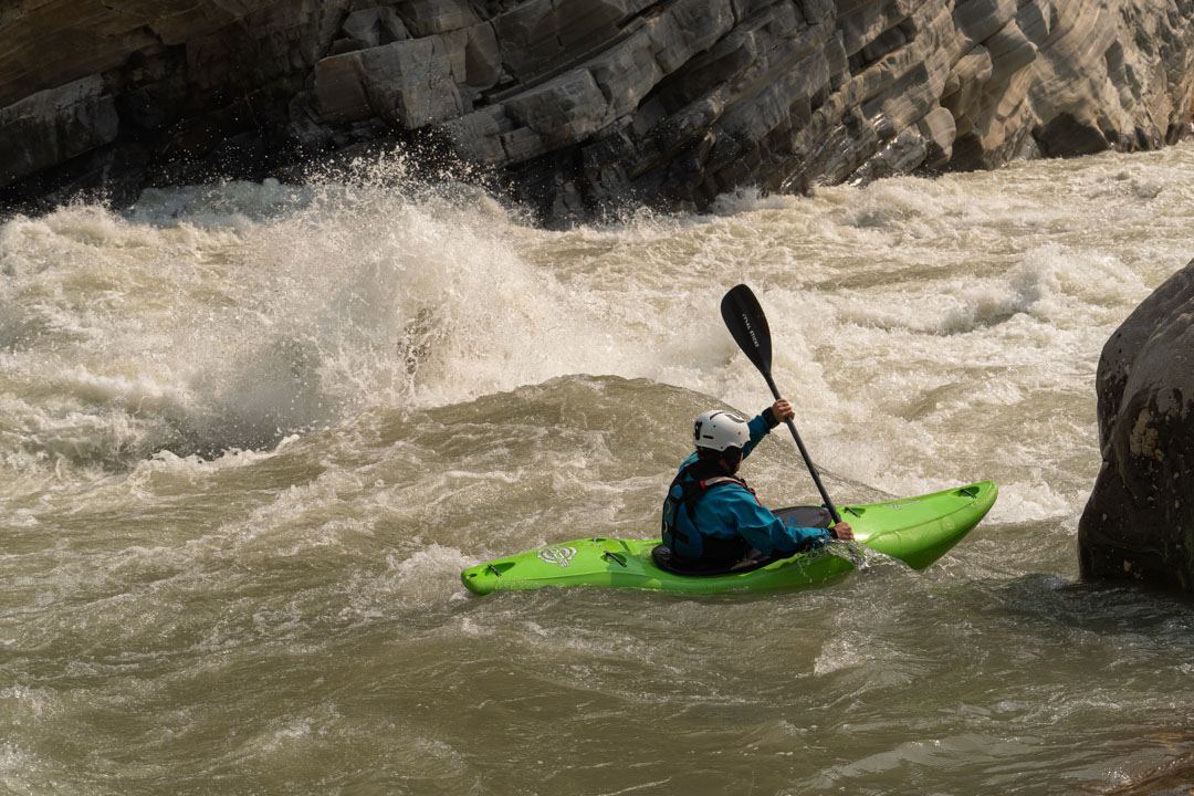
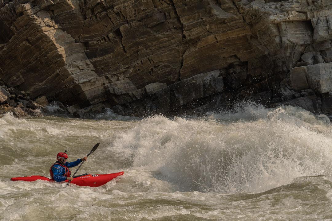
The Humla section of the Karnali river in remote western Nepal is an epic class 5 multi-day. Given its quality, difficulty, length and the variety of whitewater it is on most expedition kayakers to do list. As such it has seen many descents over the years and much is documented of it. The White Water Nepal guidebook whilst not particularly up to date contains a good guide. Liquid Lore also has an excellent write up, which includes a map (although they mention unfriendly locals in the upper reaches which is the opposite of what we found). Given what’s already out there I will stick to things I think might have changed and be worth noting.
What we have to add
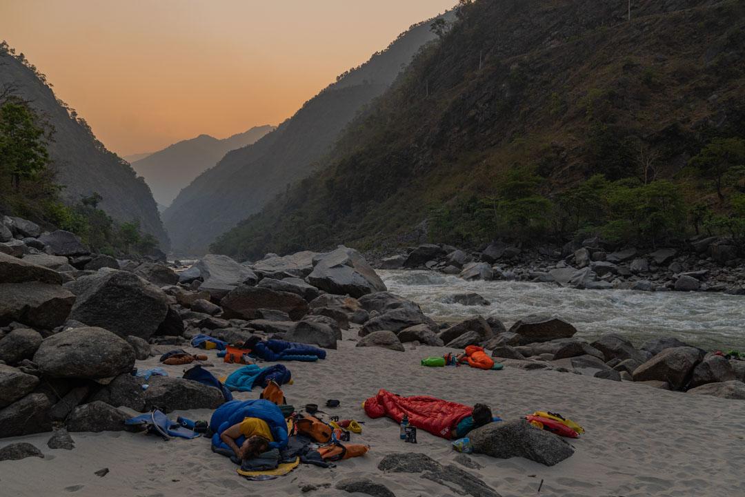
We paddled the Humla in the last week of March and first week of April 2022 in a group of six (me, Beth Morgan, Will Chick, Dan Rea-Dickins, Heidi Walsh and James Smith). Most of the descents I have read about are for the late autumn season (November to December). Plus we think we were the first group back in following the Covid lockdowns. To add to this it was high water, the logistics were especially tricky and there is significant development ongoing along the length of the river. Oh and maybe Beth and Heidi can claim it a the first female decent … unless you know of any other women to paddle it?
A bit about the run
The Humla section of the Karnali follows the river from the town of Simikot, which is the headquarters of the Humla district, with large rapids continuing to down stream of Manma, the headquarters of the Kalikot district (and the setting for one of Nepal’s most famous novels – Karnali Blues). The Lower Karnali then flows on through to Chisapani and many groups combine the two trips covering roughly 400 km. The Humla Karnali is rightly considered one of the best and longest remote class 5 runs in the world. With many setbacks it took us eleven days. In lower water fast groups have done it in a week or less. If you want to know more about the challenges we faced Beth has written a piece on it here. Her blog also gives you an idea of the water level we had compared to other groups.
A note on logistics
We had Nepalese kayaking legend Anup Gurung and his business partner Major Rajiv Chand sorting our logistics. They run a company called the Himalayan Outdoor Project and are committed to promoting Nepalese athletes in outdoor sports. They ran a tight ship and made our lives a million times easier. Without them we literally could not have organised flights.
Getting to the river
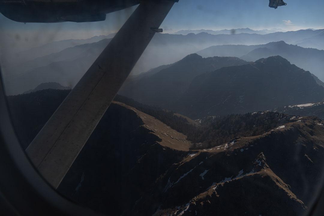
Is difficult. Simikot has no roads connecting it to the rest of Nepal yet! From Kathmandu we hired a minibus (for 45,000 rupees), but you can also get a public bus, to Nepalgunj. Where there are lots of mosquitos and probably malaria but also a small airport. You could also fly from Kathmandu if you are feeling full baller. Previously teams have been able to negotiate getting boats on to a regular plane but the airline was having non of it this year. So long story short we had to charter a plane. The bad news is that it cost $4,500 ($750 USD each when we split it between six of us). I think a group of seven would also be able to fit. The upside is that I can now say I have chartered a private plane.
To visit Simikot you also need a permit. I have no idea how to do this as Rajiv sorted it all for us. We gave him our passports in Khatmandu and when we arrived in Nepalgunj they were in a brown parcel awaiting our arrival with our permits. Thus saving us at least a day of faff in the big city.
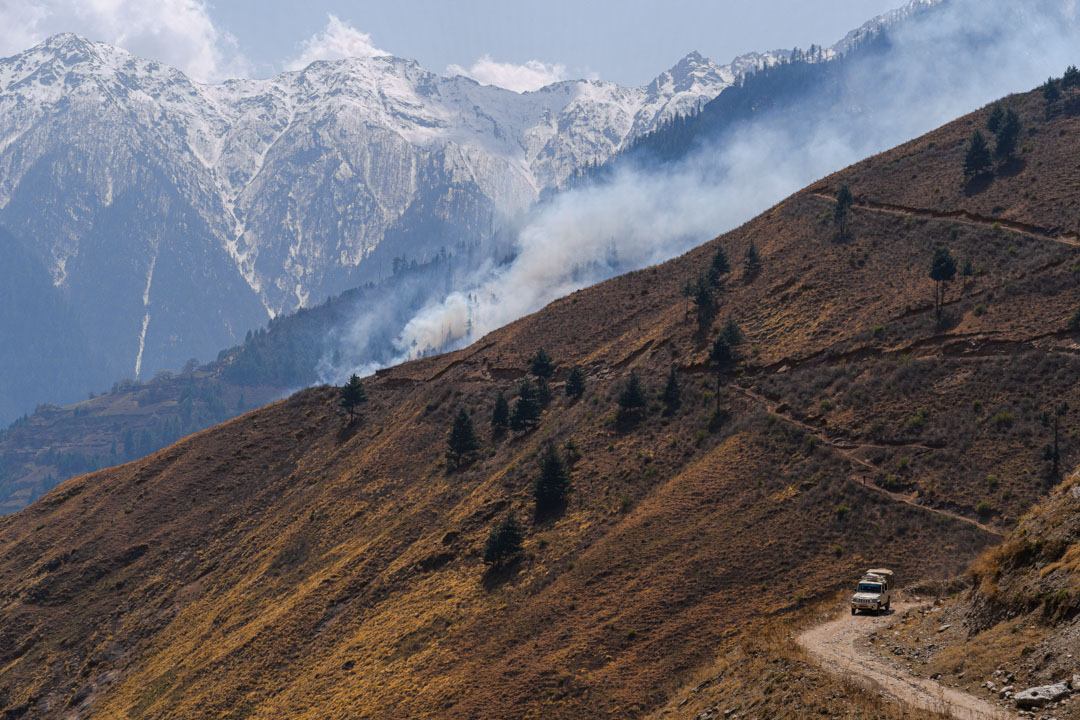
From Simikot the guide book tells you that it’s a good days walk down to the river. Nowadays there is a gravel/rocky road/track and there are several jeeps that you can hire to take you down to the river. We paid 8,000 rupees per Jeep and got three in a jeep with space to spare. It’s a 1,000 metre drop in elevation from the town to the river. So there you go. Easy!
Some notes on kit
Having watched videos of other groups and read the weather forecast and recent weather for Simikot I was very anxious that it would be really cold camping at night and on the river. I think I can be a bit chilly especially in the first few days. However we had it unseasonably hot. Having packed for sub zero temperatures at night we had 20-30 degrees. By around 3 am it was cold enough to have the sleeping bag (good to minus fifteen) pulled over you. If I was doing the trip again I would take a bag that is good to between 0 and -5 Celsius. With the addition of a good liner and a bivvy bag. Then you can switch things in and out as needed. On the same note I packed a Palm onesie. Thankfully I also had some light weight thermals as it was boiling in the day. Will and Heidi had the Tsangpo tops and these were perfect under a drysuit. Clearly we had it unseasonably hot but it really sucked carrying around 1.5 kg of winter sleeping bag that you couldn’t even sleep in. Plus I would have really liked to have a liner to get into on the warm nights.
Food
We were under the impression that there were minimal places to stop and get food. So we packed in almost everything we needed. In some ways it was good to have enough as stopping to get food all the time would slow you down. On the flip side you could save a lot of weight on the portages (which are long) by buying basics on the way. I think I would advise having a scout on google maps to see where the towns are along the river. Most places you can get dhal bhat and noodles. Maybe enough food for four days would be a good compromise.
Water
We all got sick. Will got sick twice. Being sick on a trip like this sucks. On reflection there are two possible causes: the local food; or the water. My bet is the water. I know other groups have fallen foul of this too. We all had filter bottles and I think this was ultimately our downfall. These bottles are great but they don’t remove viruses. My advice would be to use chlorine tablets first then filter the water. For sure an extra faff but it might save you a lot of time violently excreting your bodily fluids. On that note I would bring lots and lots of dioralyte, some toilet roll, loperamide and some anti-sickness meds.
Recent changes
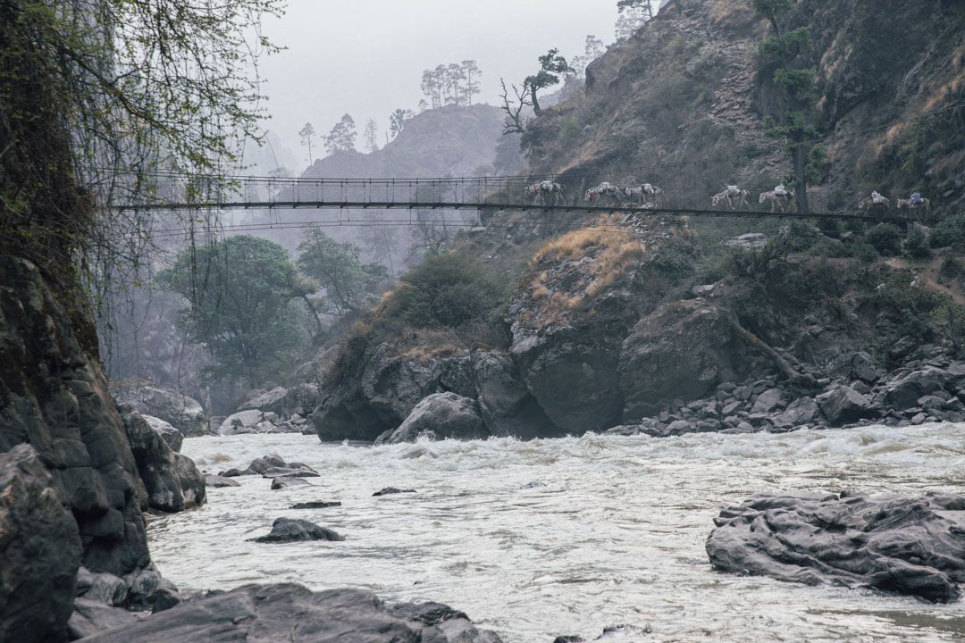
Along with the road down to the river from Simikot which was there pre-Covid pandemic, there is extensive roadbuilding along the entire river. The long portage (number three I think from memory) now has a gravel road along its entire length. If it hadn’t been for the road builders dropping rocks on us and a landslide that almost made it impossible to pass then this would have made the portage much easier than in previous years. The danger of rocks being dropped on us without notice at any moment was ever present on our decent and given the difficulty of the terrain I suspect that this will be the case for some time to come.
A planned dam
A sad theme in Nepal and across the world is that this section has active plans for a hydroelectric dam. I’m not sure where exactly but somewhere in the final big class 5 gorge. We camped below Thirpu near a place called Badalkot and in the morning got chatting to some guys surveying to see what land would be flooded by the project. We didn’t see any construction under way yet but it seems likely that doing the complete section in the future might not be possible.
Take out options
The road from the traditional take out (which is the start of the rafting run) is now tarmac. I believe in previous years driving this was deeply unpleasant. We took out at a bridge near the Aathabish Municipality Office . This is about 15 km past the last of the big rapids. Anup and Rajiv were able to sort us a mini bus from here direct to Khatmandu. Plus there was cold beer. Otherwise there is a lot of flat before the Lower Karnarli. We took out there instead of carrying on as we were exhausted.
Other notes
As with everywhere in Nepal the Humla section is not as remote and unspoilt as it clearly used to be. Along with the new road there are multiple towns along the route and sometimes this limits your camping options. There is a confluence in the guidebook before the first big class 5 gorge that is highlighted as one of the best camp spots of the trip. It even talks of hot springs. Sadly this now has a shanty town on the opposite bank with a bridge across.
Water level
There is an online gauge now near Manma (www.hydrology.gov.np). However I have no way of knowing what is high and what is low as the data from our trip is no longer online and I didn’t write down the level. An Argentinian/Kiwi/American group have just got off the Humla, late November 2022 and appeared to have similar high flows as us from the photos, the gauge was 1.34 dropping to 1.2. If you paddle it and remember to write down the level then let me know and we can try and work out how it correlates.
When we paddled it the water was grey and it was clearly high. I think the less water the better in many ways. The in-between rapids might not be as fun as they were for us but we ended up either portaging or sneaking around the big gorges as they were not runnable. However as the Liquid Lore blog says once you are at the top you are going to run it and we were able to portage and sneak everything we needed to.